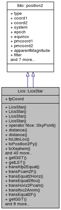
A LbcsStar object is a single sky object with location, brightness ect. More...
#include <LicsStar.h>
Public Member Functions | |
| LicsStar () | |
| default ctor. Basically not useful besides to build an empty star catalogue More... | |
| LicsStar (const lbto::position2 &star) | |
| Create from a given structure. More... | |
| LicsStar (const Nice::DMS &ra, const Nice::DMS &dec) | |
| Ctor given just a position on the sky. The proper motions, magnitudes etc are all kept at zero. More... | |
| LicsStar (const std::string &str, const std::string &typ) | |
| Ctor with a specification of a single star. This should be line conforming to http://wiki.lbto.org/bin/view/Commissioning/LBTOStarCatalogs but not a comment line. More... | |
| operator Nice::SkyPoint () const | |
| Construct a simple ra/dec pointing from this. More... | |
| double | distance (const LicsStar &oth) const |
| Distance to another star in degrees. More... | |
| double | distance (const lbto::position2 &left, const lbto::position2 &right) const |
| Distance between two stars degrees. This is the static variant of the other LicsStar::distance(), taking two stars as arguments. More... | |
| std::string | toLbtoLoc () const |
| Convert the Ra and Dec coordinates to a LBTO star catalogue number format. More... | |
| std::string | toPosition2Py () const |
| Convert the position2 structure to a Python list. More... | |
| std::string | toXephem () const |
| Convert the information to a line of the xephem format. More... | |
| std::string | object () const |
| A construed object name derived from the coordinates. More... | |
| LicsStar | propMot (const Nice::Date &t) const |
| Apply a proper motion. More... | |
| LicsStar | propMot () const |
| Apply a proper motion. More... | |
| LicsStar | precess (const Nice::Date &t) const |
| Apply proper motion and precession from catalogue origin to some other time. More... | |
| LicsStar | precess () const |
| Precess equatorial coordinate from the catalogues epoch to now. More... | |
| Lics::LicsAffTrans | diffPrecess (const Nice::Date &t) const |
| Construct the matrix of differential precession from J2000 to the time argument. More... | |
| Lics::LicsAffTrans | diffPrecess () const |
| Construct the matrix of differential precession from J2000 to now. More... | |
| Nice::DMS | getPang (const Nice::Date &t=Nice::Date::now(), const Nice::GeoLocation &geosite=Nice::GeoLocation()) const |
| compute the parallactic angle. More... | |
| Nice::SkyPoint | getHoriz (const Nice::Date &t=Nice::Date::now(), const Nice::GeoLocation &geosite=Nice::GeoLocation()) const |
| compute the horizontal coordinates (altitude, azimuth) More... | |
| Nice::DMS | getPangDot (const Nice::Date &t=Nice::Date::now(), const Nice::GeoLocation &geosite=Nice::GeoLocation()) |
| compute the first time derivative of the parallactic angle. More... | |
| Nice::DMS | derotStartAng (const Nice::Date t, const double lowLim, const double hiLim, const float dirScale, int &durat, const Nice::GeoLocation &geosite=Nice::GeoLocation()) const |
| compute a best start angle for derotation. The parallactic angle is computed from the start time into the future with 20 seconds of resolution, monitoring the maximum and minimum angles. The angle is computed which lets this derotation stay within the limits for the longest possible duration. More... | |
| Nice::DMS | derotStartAng (const Nice::Date t, const Nice::Point &travelrange, const Nice::Point &transDegree, const float cfgDirection, int &durat, const Nice::GeoLocation &geosite=Nice::GeoLocation()) const |
| compute a proposal for a best start angle for derotation. The parallactic angle is computed from the start time into the future with 20 seconds of resolution, monitoring the maximum and minimum angles. The angle is computed which lets this derotation stay within the limits for the longest possible duration. More... | |
| void | aladin () const |
| Open a firefox window to show the current region of the sky in Aladin's DSS2 . Opens a firefox screen with a 6 arcmin field-of-view around this target. More... | |
| Laos::LaosSeAOType | toWS (const lbto::position2 &targ) const |
| Decide whether this is on the HWS (< 1 arcmin) or GWS (1 arcmin-3 arcmin) WS. More... | |
| Nice::Point | toSE (const lbto::position2 &targ, const Lics::LicsAffTrans &wcs) |
| Map the sky position to SE focal plane coordinates. More... | |
| LicsStar () | |
| LicsStar (const lbto::position2 &star) | |
| LicsStar (const Nice::DMS &ra, const Nice::DMS &dec) | |
| LicsStar (const std::string &str, const std::string &typ) | |
| operator Nice::SkyPoint () const | |
| double | distance (const LicsStar &oth) const |
| double | distance (const lbto::position2 &left, const lbto::position2 &right) const |
| std::string | toLbtoLoc () const |
| std::string | toPosition2Py () const |
| std::string | toXephem () const |
| std::string | object () const |
| LicsStar | propMot (const Nice::Date &t) const |
| LicsStar | propMot () const |
| LicsStar | precess (const Nice::Date &t) const |
| LicsStar | precess () const |
| Lics::LicsAffTrans | diffPrecess (const Nice::Date &t) const |
| Lics::LicsAffTrans | diffPrecess () const |
| Nice::DMS | getPang (const Nice::Date &t=Nice::Date::now(), const Nice::GeoLocation &geosite=Nice::GeoLocation()) const |
| Nice::SkyPoint | getHoriz (const Nice::Date &t=Nice::Date::now(), const Nice::GeoLocation &geosite=Nice::GeoLocation()) const |
| Nice::DMS | getPangDot (const Nice::Date &t=Nice::Date::now(), const Nice::GeoLocation &geosite=Nice::GeoLocation()) |
| Nice::DMS | derotStartAng (const Nice::Date t, const double lowLim, const double hiLim, const float dirScale, int &durat, const Nice::GeoLocation &geosite=Nice::GeoLocation()) const |
| Nice::DMS | derotStartAng (const Nice::Date t, const Nice::Point &travelrange, const Nice::Point &transDegree, const float cfgDirection, int &durat, const Nice::GeoLocation &geosite=Nice::GeoLocation()) const |
| void | aladin () const |
| Laos::LaosSeAOType | toWS (const lbto::position2 &targ) const |
| Nice::Point | toSE (const lbto::position2 &targ, const Lics::LicsAffTrans &wcs) |
Static Public Member Functions | |
| static Nice::DMS | getGST (const Nice::Date &t=Nice::Date::now()) |
| compute the apparent Greenwich sidereal time. More... | |
| static Nice::DMS | getLST (const Nice::Date &t=Nice::Date::now(), const Nice::GeoLocation &geosite=Nice::GeoLocation()) |
| compute the local sidereal time. More... | |
| static Lics::LicsAffTrans | transKfp2Equat (const double mm2as) |
| Construct transformation from focal plane to equatorial coordinates. This involves a rotation by the 18.5 degrees (the same for SX and DX) and a homogenous radial scaling. There is no shift component: all parameters in the target and image space are deltas with respect to the beam center. More... | |
| static Lics::LicsAffTrans | transPcam2F (const Lics::LicsIIFSide &sdx) |
| Construct transformation from Pcam pixel coordinates to SE F coordinates. More... | |
| static Lics::LicsAffTrans | transEquat2Horiz (const double pang) |
| Transformation matrix which rotates sky delta (top coordinate) /alpha (bottom coordinate) directions to the azimuth (top coordinate)/ altitude (bottom coordinate) directions. The delta/alpha coordinates are in the presseced coordinate system of date. More... | |
| static Lics::LicsAffTrans | transEquat2Ifoc (const Lics::LicsIIFSide &sdx, const double pang) |
| Transformation matrix which rotates sky delta-alpha directions to the instrument focus aligned with the platform. Computes the transformation matrix which rotates sky delta (top coordinate) /alpha (bottom coordinate) directions to the instrument focus aligned with the platform, just after the annular mirror. More... | |
| static Lics::LicsAffTrans | transHoriz2Pcam (const Lics::LicsIIFSide &sdx, const double motang) |
| Transformation matrix which rotates topocentric horizontal coordinates to patrol camera coordinates. More... | |
| static Lics::LicsAffTrans | transIfoc2Annm (const Lics::LicsIIFSide &sdx, const double motang) |
| Transformation matrix which rotates platform horizontal coordinates (radians) to GWS SE motor coordinates. More... | |
| static Lics::LicsAffTrans | transEquat2F (const Lics::LicsIIFSide &sdx, const Laos::LaosSeAOType &ghws, const double pang, const double motang, const std::string &unit) |
| Transformation matrix from sky delta/alpha coordinates to SE F or Patrol positions. More... | |
| static Nice::DMS | getGST (const Nice::Date &t=Nice::Date::now()) |
| static Nice::DMS | getLST (const Nice::Date &t=Nice::Date::now(), const Nice::GeoLocation &geosite=Nice::GeoLocation()) |
| static Lics::LicsAffTrans | transKfp2Equat (const double mm2as) |
| static Lics::LicsAffTrans | transPcam2F (const Lics::LicsIIFSide &sdx) |
| static Lics::LicsAffTrans | transEquat2Horiz (const double pang) |
| static Lics::LicsAffTrans | transEquat2Ifoc (const Lics::LicsIIFSide &sdx, const double pang) |
| static Lics::LicsAffTrans | transHoriz2Pcam (const Lics::LicsIIFSide &sdx, const double motang) |
| static Lics::LicsAffTrans | transIfoc2Annm (const Lics::LicsIIFSide &sdx, const double motang) |
| static Lics::LicsAffTrans | transEquat2F (const Lics::LicsIIFSide &sdx, const Laos::LaosSeAOType &ghws, const double pang, const double motang, const std::string &unit) |
Public Attributes | |
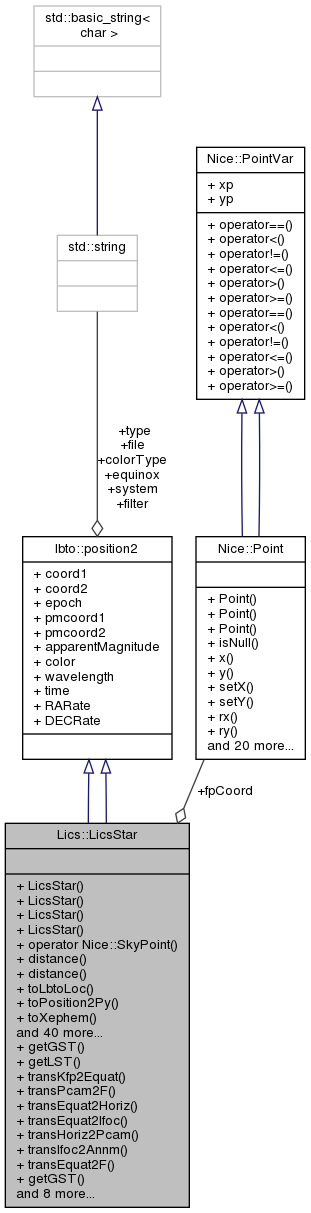
| Nice::Point | fpCoord |
| storage for some 2D focal plane coordinates. This stores the two coordinates from the recent toSE() call and is merely facilitating the python interface. So this is not referring to one single patrol camera or star enlarger focal plane but mutable by subsequent calls. More... | |
 Public Attributes inherited from lbto::position2 Public Attributes inherited from lbto::position2 | |
| ::std::string | type |
| ::Ice::Double | coord1 |
| ::Ice::Double | coord2 |
| ::std::string | system |
| ::Ice::Double | epoch |
| ::std::string | equinox |
| ::Ice::Double | pmcoord1 |
| ::Ice::Double | pmcoord2 |
| ::Ice::Double | apparentMagnitude |
| ::std::string | filter |
| ::Ice::Double | color |
| ::std::string | colorType |
| ::Ice::Float | wavelength |
| ::std::string | file |
| ::Ice::Double | time |
| ::Ice::Double | RARate |
| ::Ice::Double | DECRate |
Detailed Description
A LbcsStar object is a single sky object with location, brightness ect.
- Since
- 2017-01-18
Constructor & Destructor Documentation
◆ LicsStar() [1/8]
| Lics::LicsStar::LicsStar | ( | ) |
default ctor. Basically not useful besides to build an empty star catalogue
- Since
- 2017-01-18
◆ LicsStar() [2/8]
| Lics::LicsStar::LicsStar | ( | const lbto::position2 & | star | ) |
Create from a given structure.
- Parameters
-
star The contents to be copied in.
- Since
- 2017-03-17
◆ LicsStar() [3/8]
Ctor given just a position on the sky. The proper motions, magnitudes etc are all kept at zero.
- Parameters
-
ra Right ascension dec Declination
- Since
- 2017-01-21
◆ LicsStar() [4/8]
Ctor with a specification of a single star. This should be line conforming to http://wiki.lbto.org/bin/view/Commissioning/LBTOStarCatalogs but not a comment line.
- Parameters
-
str The string. This is typically a line of a star catalogue. typ The indication of how this string is formatted. Should be "lbto" or "nomad". No other formats are implemented.
- Since
- 2017-01-20
◆ LicsStar() [5/8]
| Lics::LicsStar::LicsStar | ( | ) |
◆ LicsStar() [6/8]
| Lics::LicsStar::LicsStar | ( | const lbto::position2 & | star | ) |
◆ LicsStar() [7/8]
◆ LicsStar() [8/8]
Member Function Documentation
◆ aladin() [1/2]
| void Lics::LicsStar::aladin | ( | ) | const |
Open a firefox window to show the current region of the sky in Aladin's DSS2 . Opens a firefox screen with a 6 arcmin field-of-view around this target.
- Since
- 2017-06-26
◆ aladin() [2/2]
| void Lics::LicsStar::aladin | ( | ) | const |
◆ derotStartAng() [1/4]
| Nice::DMS Lics::LicsStar::derotStartAng | ( | const Nice::Date | t, |
| const double | lowLim, | ||
| const double | hiLim, | ||
| const float | dirScale, | ||
| int & | durat, | ||
| const Nice::GeoLocation & | geosite = Nice::GeoLocation() |
||
| ) | const |
compute a best start angle for derotation. The parallactic angle is computed from the start time into the future with 20 seconds of resolution, monitoring the maximum and minimum angles. The angle is computed which lets this derotation stay within the limits for the longest possible duration.
- Parameters
-
t The civil time in UTC time scales at which derotation should start. Note that this can be a very rough estimate (of the order of 1 or 2 minutes) because the actual start of the derotation will determine the derotator angles. This here is just to get an estimate about the rough extrapolation of the trajectory into the future. lowLim The lower limit switch of the motor (in degrees). This is usually obtained by converting the TRAVELRANGE[0] by the TRANS.DEGREE of the configuration. hiLim The high limit switch (in degrees) This is usually obtained by converting the TRAVELRANGE[1] by the TRANS.DEGREE of the configuration. dirScale The sign of this value must be positive if positive steps lead to positive angles, otherwise negative. So the sign should be the sign of the factor in TRANS.DEGREE in the configuration file, that means negative for the GWS DX as of 2017-05-03, otherwise positive. The absolute value should be the absolute value of CFG.DIRECTION, which is 0.5 for the two K-mirrors and 1 for the 3 other cases. [in,out] durat The maximum time of extrapolating the trajectory (in seconds) On return the time that is actually possible within the travel range. geosite Implies the geographic longitude of the observatory. The default is the LBTO in Arizona, the default ctor for the GeoLocation.
- Returns
- The motor angle (in degrees) that maximises the time until the trajectory steps outside the limit switches. This is in units of the nominal motor angles as used elsewhere, taking sign and value of dirScale into account. The value could be used straight away to send the derototar motor to that angle to start derotation at time t.
- Since
- 2017-05-03
- 2018-06-26 return the time in durat.
◆ derotStartAng() [2/4]
| Nice::DMS Lics::LicsStar::derotStartAng | ( | const Nice::Date | t, |
| const double | lowLim, | ||
| const double | hiLim, | ||
| const float | dirScale, | ||
| int & | durat, | ||
| const Nice::GeoLocation & | geosite = Nice::GeoLocation() |
||
| ) | const |
◆ derotStartAng() [3/4]
| Nice::DMS Lics::LicsStar::derotStartAng | ( | const Nice::Date | t, |
| const Nice::Point & | travelrange, | ||
| const Nice::Point & | transDegree, | ||
| const float | cfgDirection, | ||
| int & | durat, | ||
| const Nice::GeoLocation & | geosite = Nice::GeoLocation() |
||
| ) | const |
compute a proposal for a best start angle for derotation. The parallactic angle is computed from the start time into the future with 20 seconds of resolution, monitoring the maximum and minimum angles. The angle is computed which lets this derotation stay within the limits for the longest possible duration.
- Parameters
-
t The civil time in UTC time scales at which derotation should start. travelrange The motor limit switches in units of steps. This is usually obtained by reading the TRAVELRANGE in the configuration. transDegree The conversion matrix for conversion of steps to degress. This is usually obtained by reading TRANS.DEGREE of the configuration. cfgDirection The value of CFG.DIRECTION of the configuration. The absolute value is 0.5 for K-mirrors and 1.0 for the others. geosite Implies the geographic longitude of the observatory. The default is the LBTO in Arizona, the default ctor for the GeoLocation.
- Returns
- The motor angle (in degrees) that maximises the time until the trajectory steps outside the limit switches. This is in units of the nominal motor angles as used elsewhere. This could be used straight away to send the derototar motor to that angle to start derotation at time t.
- Since
- 2017-05-03
- 2018-01-23 safetey distance in steps from ends increased from 100 to 500.
◆ derotStartAng() [4/4]
| Nice::DMS Lics::LicsStar::derotStartAng | ( | const Nice::Date | t, |
| const Nice::Point & | travelrange, | ||
| const Nice::Point & | transDegree, | ||
| const float | cfgDirection, | ||
| int & | durat, | ||
| const Nice::GeoLocation & | geosite = Nice::GeoLocation() |
||
| ) | const |
◆ diffPrecess() [1/4]
| Lics::LicsAffTrans Lics::LicsStar::diffPrecess | ( | const Nice::Date & | t | ) | const |
Construct the matrix of differential precession from J2000 to the time argument.
- Parameters
-
t The time when the coordinates should be valid.
- Since
- 2018-01-27
◆ diffPrecess() [2/4]
| Lics::LicsAffTrans Lics::LicsStar::diffPrecess | ( | const Nice::Date & | t | ) | const |
◆ diffPrecess() [3/4]
| Lics::LicsAffTrans Lics::LicsStar::diffPrecess | ( | ) | const |
◆ diffPrecess() [4/4]
| Lics::LicsAffTrans Lics::LicsStar::diffPrecess | ( | ) | const |
Construct the matrix of differential precession from J2000 to now.
- Since
- 2018-01-27
◆ distance() [1/4]
◆ distance() [2/4]
Distance to another star in degrees.
- Parameters
-
oth The other star to which the distance (along a great arc) is measured.
- Returns
- The distance on the sky in degrees.
- Since
- 2017-01-18
◆ distance() [3/4]
| double Lics::LicsStar::distance | ( | const lbto::position2 & | left, |
| const lbto::position2 & | right | ||
| ) | const |
◆ distance() [4/4]
| double Lics::LicsStar::distance | ( | const lbto::position2 & | left, |
| const lbto::position2 & | right | ||
| ) | const |
Distance between two stars degrees. This is the static variant of the other LicsStar::distance(), taking two stars as arguments.
- Parameters
-
left The first star of the pair. right The second star of the pair.
- Returns
- The distance between the stars on the sky in degrees.
- Since
- 2017-07-13
◆ getGST() [1/2]
|
static |
◆ getGST() [2/2]
|
static |
compute the apparent Greenwich sidereal time.
- Parameters
-
[in] t The civil time in UTC time scales. The default is "now", the time of the function call.
- Returns
- Greenwich apparent (true) sidereal time. The return value is basically an angle with the usual equivalence that 360 deg = 24 hrs. For human read purposes this is to be rendered with value.reduce().toHMSString() to get hours, minutes and seconds.
◆ getHoriz() [1/2]
| Nice::SkyPoint Lics::LicsStar::getHoriz | ( | const Nice::Date & | t = Nice::Date::now(), |
| const Nice::GeoLocation & | geosite = Nice::GeoLocation() |
||
| ) | const |
compute the horizontal coordinates (altitude, azimuth)
- Parameters
-
t The civil time in UTC time scales. The default is "now", the time of the function call. geosite Implies the geographic longitude of the observatory. The default is the LBTO in Arizona, the default ctor for the GeoLocation.
- Returns
- The two coordinates in the horizontal system.
- Since
- 2017-05-29
◆ getHoriz() [2/2]
| Nice::SkyPoint Lics::LicsStar::getHoriz | ( | const Nice::Date & | t = Nice::Date::now(), |
| const Nice::GeoLocation & | geosite = Nice::GeoLocation() |
||
| ) | const |
◆ getLST() [1/2]
|
static |
◆ getLST() [2/2]
|
static |
compute the local sidereal time.
- Parameters
-
t The civil time in UTC time scales. The default is "now", the time of the function call. geosite Implies the geographic longitude of the observatory. The default is the LBTO in Arizona, the default ctor for the GeoLocation.
- Returns
- Apparent (a.k.a true) sidereal time. Effectively the Greenwich sidereal time plus the (East) longitude of the observer. The return value is basically an angle. For human read purposes this is to be rendered with value.reduce().toHMSString() to get hours, minutes and seconds. Subtract the right ascension to get hour angle.
◆ getPang() [1/2]
| Nice::DMS Lics::LicsStar::getPang | ( | const Nice::Date & | t = Nice::Date::now(), |
| const Nice::GeoLocation & | geosite = Nice::GeoLocation() |
||
| ) | const |
compute the parallactic angle.
- Parameters
-
t The civil time in UTC time scales. The default is "now", the time of the function call. geosite Implies the geographic longitude of the observatory. The default is the LBTO in Arizona, the default ctor for the GeoLocation.
- Returns
- Parallactic angle of this star at the given time.
- Since
- 2017-04-06
◆ getPang() [2/2]
| Nice::DMS Lics::LicsStar::getPang | ( | const Nice::Date & | t = Nice::Date::now(), |
| const Nice::GeoLocation & | geosite = Nice::GeoLocation() |
||
| ) | const |
◆ getPangDot() [1/2]
| Nice::DMS Lics::LicsStar::getPangDot | ( | const Nice::Date & | t = Nice::Date::now(), |
| const Nice::GeoLocation & | geosite = Nice::GeoLocation() |
||
| ) |
compute the first time derivative of the parallactic angle.
- Parameters
-
t The civil time in UTC time scales. The default is "now", the time of the function call. geosite Implies the geographic longitude of the observatory. The default is the LBTO in Arizona, the default ctor for the GeoLocation.
- Returns
- derivative of parallactic angle of this star at the given time per second.
- Since
- 2017-04-06
◆ getPangDot() [2/2]
| Nice::DMS Lics::LicsStar::getPangDot | ( | const Nice::Date & | t = Nice::Date::now(), |
| const Nice::GeoLocation & | geosite = Nice::GeoLocation() |
||
| ) |
◆ object() [1/2]
| std::string Lics::LicsStar::object | ( | ) | const |
◆ object() [2/2]
| std::string Lics::LicsStar::object | ( | ) | const |
A construed object name derived from the coordinates.
- Returns
- The local radec[] numbers are converted to JHHMMSS+-DDMMSS
- Since
- 2017-03-30
◆ operator Nice::SkyPoint() [1/2]
| Lics::LicsStar::operator Nice::SkyPoint | ( | ) | const |
Construct a simple ra/dec pointing from this.
- Returns
- Cast into the two angles of a ra/dec pair.
- Since
- 2017-01-18
◆ operator Nice::SkyPoint() [2/2]
| Lics::LicsStar::operator Nice::SkyPoint | ( | ) | const |
◆ precess() [1/4]
| LicsStar Lics::LicsStar::precess | ( | const Nice::Date & | t | ) | const |
◆ precess() [2/4]
| Lics::LicsStar Lics::LicsStar::precess | ( | const Nice::Date & | t | ) | const |
Apply proper motion and precession from catalogue origin to some other time.
- Parameters
-
t The time when the coordinates should be valid.
- Returns
- a star moved from its epoch to the coordinates at time t.
- Warning
- This should not be called in conjunction with propMot(). The two functions are to be used exclusively, not in succession.
- Since
- 2017-06-20
◆ precess() [3/4]
| LicsStar Lics::LicsStar::precess | ( | ) | const |
◆ precess() [4/4]
| Lics::LicsStar Lics::LicsStar::precess | ( | ) | const |
Precess equatorial coordinate from the catalogues epoch to now.
- Returns
- a star moved from its epoch to now according to proper motion and Earth precession.
- Since
- 2017-03-01
◆ propMot() [1/4]
| Lics::LicsStar Lics::LicsStar::propMot | ( | const Nice::Date & | t | ) | const |
Apply a proper motion.
- Parameters
-
t The time when the motion ought to be finished.
- Returns
- a star moved from its epoch to the epoch of t according to its proper motion vector.
- Warning
- apparently not used anywhere (superseeded by precess)
- Since
- 2017-02-28
◆ propMot() [2/4]
| LicsStar Lics::LicsStar::propMot | ( | const Nice::Date & | t | ) | const |
◆ propMot() [3/4]
| Lics::LicsStar Lics::LicsStar::propMot | ( | ) | const |
Apply a proper motion.
- Returns
- a star moved from its epoch to now according to its proper motion vector.
- Warning
- apparently not used anywhere (superseeded by precess)
- Since
- 2017-02-28
◆ propMot() [4/4]
| LicsStar Lics::LicsStar::propMot | ( | ) | const |
◆ toLbtoLoc() [1/2]
| std::string Lics::LicsStar::toLbtoLoc | ( | ) | const |
Convert the Ra and Dec coordinates to a LBTO star catalogue number format.
- Returns
- A string of the form HH MM SS.ssss sDD HH MM SS.sss .
◆ toLbtoLoc() [2/2]
| std::string Lics::LicsStar::toLbtoLoc | ( | ) | const |
◆ toPosition2Py() [1/2]
| std::string Lics::LicsStar::toPosition2Py | ( | ) | const |
◆ toPosition2Py() [2/2]
| std::string Lics::LicsStar::toPosition2Py | ( | ) | const |
◆ toSE() [1/2]
| Nice::Point Lics::LicsStar::toSE | ( | const lbto::position2 & | targ, |
| const Lics::LicsAffTrans & | wcs | ||
| ) |
◆ toSE() [2/2]
| Nice::Point Lics::LicsStar::toSE | ( | const lbto::position2 & | targ, |
| const Lics::LicsAffTrans & | wcs | ||
| ) |
Map the sky position to SE focal plane coordinates.
- Parameters
-
[in] targ The coordinate that defines the center of the pointing. [in] wcs The transform which converts (delta/alpha) differential coordinats (radians) to units of the points. The exact meaning depends on the current star definition: if the star is already precessed, the wcs should not include an initial differential precession with LicsStar::diffPrecess().
- Returns
- the x and y coordinate in the unit chosen.
- Since
- 2018-01-27
- 2018-04-24 stores the result also in the member fpCoord
◆ toWS() [1/2]
| Laos::LaosSeAOType Lics::LicsStar::toWS | ( | const lbto::position2 & | targ | ) | const |
◆ toWS() [2/2]
| Laos::LaosSeAOType Lics::LicsStar::toWS | ( | const lbto::position2 & | targ | ) | const |
Decide whether this is on the HWS (< 1 arcmin) or GWS (1 arcmin-3 arcmin) WS.
- Parameters
-
targ The center target which sets the origin of the distance scales.
- Returns
- GWS or HWS.
- Since
- 2017-07-13
◆ toXephem() [1/2]
| std::string Lics::LicsStar::toXephem | ( | ) | const |
Convert the information to a line of the xephem format.
- Returns
- A string of the form name,f|S,HH:MM:SS|prmp,DD:MM:SS|prmp,magnitude,2000
- Since
- 2017-12-07
◆ toXephem() [2/2]
| std::string Lics::LicsStar::toXephem | ( | ) | const |
◆ transEquat2F() [1/2]
|
static |
◆ transEquat2F() [2/2]
|
static |
Transformation matrix from sky delta/alpha coordinates to SE F or Patrol positions.
- Parameters
-
[in] sdx The SX or DX indicator. [in] ghws Indicates whether the transformation is to HWS Pcam, HWS SE or GWS SE coordinates. [in] pang The parallactic angle at the time derotation starts (in radians). [in] motAng The nominal position of the motor (K-mirror, GWS bearing) at the same time as pang, in radians. The effective angle is a sum or difference (depending on sign conventions on the motor side) of parallactic and motor angle. unit Either "mm" or "um" indicating millimeters or microns for the Points created.
- Returns
- The transformation which must be applied to dec/ra coordinates to obtain the SE positions. Note that the first (upper) component of the dec/ra vector must be the declination and the second (lower) the right ascension (multiplied by the cos(delta)). Both are assumend to be in radians relative to the beam center, at the current date. For the full transformation including precession from 2000 equatorial coordinates, the caller must pre-multipliby by the LicsStar::diffPrecess() matrix or apply the transformation to precessed star coordinates.
- Since
- 2017-11-16
◆ transEquat2Horiz() [1/2]
|
static |
◆ transEquat2Horiz() [2/2]
|
static |
Transformation matrix which rotates sky delta (top coordinate) /alpha (bottom coordinate) directions to the azimuth (top coordinate)/ altitude (bottom coordinate) directions. The delta/alpha coordinates are in the presseced coordinate system of date.
- Parameters
-
[in] pang The parallactic angle at the applicable time (in radians).
- Returns
- The transformation which must be applied to dec/ra coordinates to obtain the (az/alt) coordinates. That result is intrinsically unitless (a pure translation without scale). The transformation has determinant +1 because there is no flip: the input and the output frames are both right-handed, which means, one gets the lower unit axis rotating the upper axis ccw .
- Since
- 2017-11-15
◆ transEquat2Ifoc() [1/2]
|
static |
◆ transEquat2Ifoc() [2/2]
|
static |
Transformation matrix which rotates sky delta-alpha directions to the instrument focus aligned with the platform. Computes the transformation matrix which rotates sky delta (top coordinate) /alpha (bottom coordinate) directions to the instrument focus aligned with the platform, just after the annular mirror.
- Parameters
-
[in] sdx The SX or DX indicator for the LBT side. This is effectively determing which additional rotation is implied by M3, +- 108.5 degrees. [in] pang The parallactic angle at the applicable time (in radians).
- Returns
- The transformation which must be applied to dec/ra coordinates to obtain the place at the instrument focus. That result is intrinsically unitless (a pure rotation without scale). The transformation has determinant +1 because there is no flip: the input and the output frames are both right-handed, which means, one gets the lower unit axis rotating the upper axis ccw .
- Since
- 2017-11-15
◆ transHoriz2Pcam() [1/2]
|
static |
Transformation matrix which rotates topocentric horizontal coordinates to patrol camera coordinates.
- Parameters
-
[in] sdx The SX or DX indicator. [in] motAng The nominal position of the motor (K-mirror) at the same time as pang, in radians. The effective angle is a sum or difference (depending on sign conventions on the motor side) of parallactic and motor angle.
- Returns
- The transformation which must be applied to horizontal topocentric coordinates (radians) to get unitless Pcam pixels. There is no shift component in that transformation, assuming that the input and output coordinates are deltas in arcsecond and in pixels measured from some beam center.
- Since
- 2017-11-16
◆ transHoriz2Pcam() [2/2]
|
static |
◆ transIfoc2Annm() [1/2]
|
static |
◆ transIfoc2Annm() [2/2]
|
static |
Transformation matrix which rotates platform horizontal coordinates (radians) to GWS SE motor coordinates.
- Parameters
-
[in] sdx The SX or DX indicator. [in] motAng The nominal position of the motor GWS bearing at the same time as pang, in radians. The effective angle is a sum or difference (depending on sign conventions on the motor side) of parallactic and motor angle.
- Returns
- The transformation which must be applied to right-handed az/alt coordinates to obtain the SE positions [um]. This has negative determinant because the annular mirror is involved which flips the component which is horizontal in the bench system.
- Since
- 2017-08-03
◆ transKfp2Equat() [1/2]
|
static |
◆ transKfp2Equat() [2/2]
|
static |
Construct transformation from focal plane to equatorial coordinates. This involves a rotation by the 18.5 degrees (the same for SX and DX) and a homogenous radial scaling. There is no shift component: all parameters in the target and image space are deltas with respect to the beam center.
- Parameters
-
[in] mm2as Plate scale mm per arcseconds in that focal plane.
- Returns
- The affine transformation from KFP coordinates [mm] to sky equatorial coordinates [rad]. Precession is not included, so the equatorial coordinates are those of date.
- Since
- 2017-11-16
◆ transPcam2F() [1/2]
|
static |
◆ transPcam2F() [2/2]
|
static |
Construct transformation from Pcam pixel coordinates to SE F coordinates.
This is basically Kalyan's affine transformation of Feb 2017 (separately on SX or DX) to flip-rotate-shift the pixel coordinates in a PCAM image to get micrometers in the HWS SE plane. This includes a scaling by roughly a factor of 110 microns per pixel. The determinant of the transformation is negative, indicating the flip in the (relative) image orientation. The associated shift component takes care of moving the (0,0) pixel of the patrol camera (just outside the lower left edge of the effective readout) to the center of the star enlarger global motor coordinates.
- Returns
- The affine transformation from PCam pixel units to SE microns.
- Since
- 2017-10-24
Member Data Documentation
◆ fpCoord
| Nice::Point Lics::LicsStar::fpCoord |
storage for some 2D focal plane coordinates. This stores the two coordinates from the recent toSE() call and is merely facilitating the python interface. So this is not referring to one single patrol camera or star enlarger focal plane but mutable by subsequent calls.
- Since
- 2018-04-24
The documentation for this class was generated from the following files:
- ln/lics/src/starcat/LicsStar.h
- ln/lics/src/starcat/LicsStar.cc